 Official Government Website
Introduction
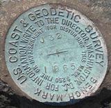
The Geodetic Control Theme provides the horizontal and vertical positional underpinnings for all spatial datasets in Idaho.
Mission
The current focus of the GC-TWG is the real-time correction network, the multistate control point database (MCPD) and working with the National Geodetic Survey (NGS) to develop a revised spatial reference system for Idaho as a result of NATRF2022.
Goals
- Promote the use of the Control Point Database. This includes promoting people to use the data, but also promoting contributions of new surveyed control points to the database.
- Continue working with the National Geodetic Survey on the modernization of spatial reference systems for Idaho.
- Continued collaboration with The Utah Reference Network to provide real time GNSS corrections for Idaho
Framework Layers

Leadership
Cory Scoffield
Idaho State University
(208) 282-3606
coryscoffield@isu.edu
Stewart Ward
Dioptera
(208) 237-7373
stewart@dioptrageomatics.com
Next Meeting
Meetings are held on the 4th Thursday of each month from 3-4 PM MTN. Check the Calendar for more information.
Meeting Notes
Element Workgroups
Control Points
- Control Point Standard (effective 9/15/2016)
- MCPD Idaho Framework Layer
Real Time Network
Resources
Idaho State University GIS Center
eMail – Multistate Control Point Database
Understanding, Preparing for, and Working with Idaho SPCS 2022