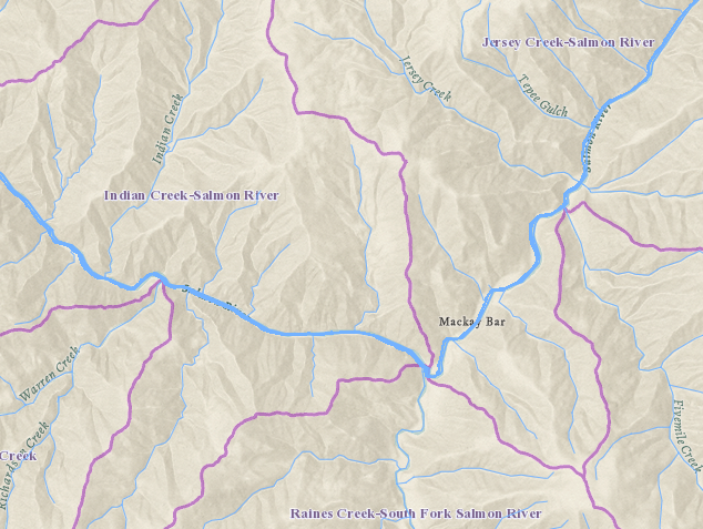
Hydrography is the science of the measurement, description, and mapping of the surface waters of the earth.
The Hydrography Technical Working Group (Hydro TWG) focus is to enhance the digital representation of streams, lakes, canals and other surface water features as well as watersheds in the State of Idaho. The Hydro TWG facilitates contributions to national hydrography related datasets, as well as assists in coordination and development of standards for Idaho’s hydrography needs.
Formal stewardship is in place and improvements are incorporated from local sources via the USGS Markup Application. The Idaho Department of Water Resources (IDWR) is the Framework Steward.
Vision
To provide a forum to coordinate and facilitate creation of current and correct digital hydrography for Idaho that is useful at a local, state, regional and national level through updating of the Idaho Map (TIM) Framework Datasets recognized for the Hydrography Framework Data Theme elements.

Goals
- Facilitate contributions to national hydrography related datasets:
- Disseminating information on upcoming updates and changes to the national datasets and the tools for editing them.
- Sharing success stories from users who have solved real world problems using hydrography data.
- Providing a mechanism for edit review and conflict resolution in order to provide the most accurate assessment of hydrography in the state.
- Assist in coordination and development of standards for Idaho’s hydrography requirements as needed.
Uses of Digital Hydrography
The data have assisted with monitoring water quality and availability, agriculture, flood risk management, and environmental health, among many others. For more information on the benefits from improved hydrography, please see the USGS Hydrography Requirements and Benefits Study.
Standards
Stewardship Plan – Watersheds
Stewardship Plan – Water Features
Leadership
Danielle Favreau, Chair
Idaho Department of Water Resources
(208) 287-4800
danielle.favreau@idwr.idaho.gov
Framework Datasets
The Idaho Map (TIM) is a collection of Framework Data Themes as envisioned in the Idaho Spatial Data Infrastructure. At the March 19, 2015 Idaho Geospatial Council-Executive Committee (IGC-EC) meeting, The Idaho Map (TIM) Framework Datasets were recognized for the Hydrography Framework Data Theme elements. These datasets were recognized through the process outlined in the Idaho Technology Authority Guideline G350.
- The National Hydrography Dataset (NHD) is recognized by the IGC-EC as the Framework Dataset for the Water Features Element of the Hydrography Framework Data Theme for Idaho.
- The Watershed Boundary Dataset (WBD) is recognized by the IGC-EC as the Framework Data set of the Watershed Element of the Hydrography Framework Data Theme for Idaho.
Meeting Minutes
Element Workgroups
Water Features
Danielle Favreau
Idaho Dept. Water Resources
(208) 287-4800
Danielle.Favreau@idwr.idaho.gov
Watersheds
Danielle Favreau
Idaho Dept. Water Resources
(208) 287-4800
Danielle.Favreau@idwr.idaho.gov
 Official Government Website